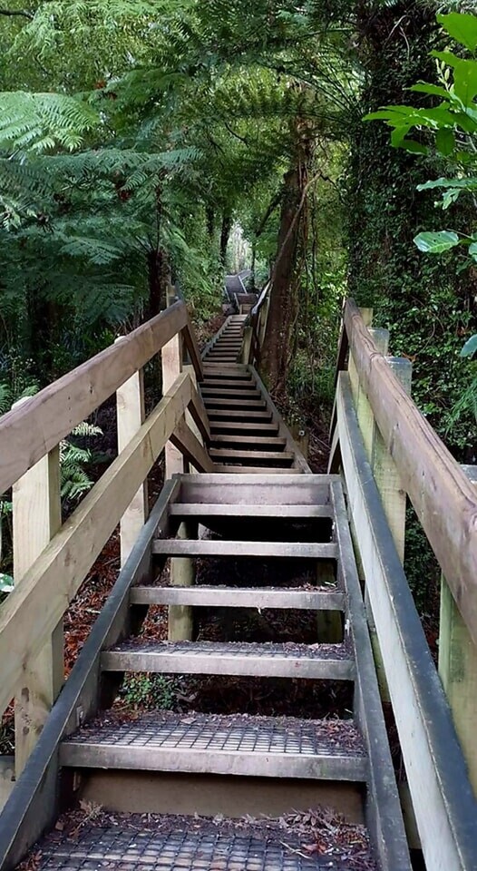
Hakarimata Range is a range of hills on the western edge of Ngāruawāhia township, in the Waikato region of New Zealand, overlooking the confluence of the Waikato and Waipā Rivers. The Hakarimata Range is separated from the Taupiri Range by the Taupiri Gorge, through which the Waikato River flows. Follow the Waterworks Walk to just before the dam where the track branches off to the right and climbs steeply up a well constructed set of steps and stairs. Be careful on the narrower parts of the Waterworks Walk between the waterfall and the stairs. Look and listen out for falling rocks and don’t stop on these sections, especially in bad weather.It is a 335 metre climb from Brownlee Avenue to the summit with 1,349 steps. The track meets the Hakarimata Walkway and the summit tower at 374 metres above sea level.
Follow the Waterworks Walk to just before the dam where the track branches off to the right and climbs steeply up a well constructed set of steps and stairs. Be careful on the narrower parts of the Waterworks Walk between the waterfall and the stairs. Look and listen out for falling rocks and don’t stop on these sections, especially in bad weather.
It is a 335 metre climb from Brownlee Avenue to the summit with 1,349 steps. The track meets the Hakarimata Walkway and the summit tower at 374 metres above sea level.
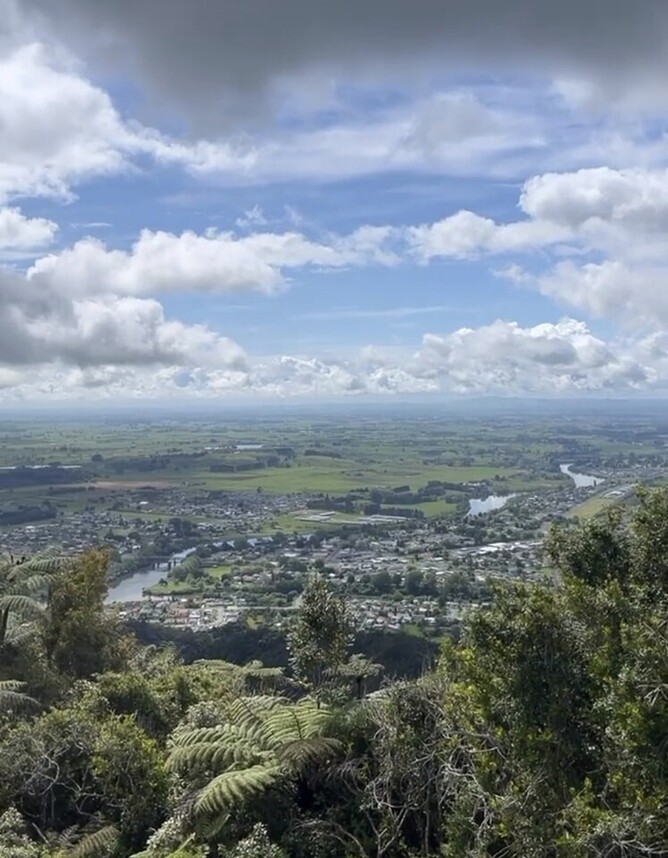
In spring you can smell the scented daphne, Alseuosmia quercifolia or topara growing beside the track. The tower provides good views out towards the coast and across the Waikato Basin and down to Ruapehu on a clear day.
Getting there
The Hakarimata Summit Track is accessed via the Waterworks Walk. The Waterworks Walk starts on Brownlee Avenue, off Hakarimata Road, approx. 1 km north of Ngaruawahia.
Click HERE for more details